Llyn Llydaw
OS Grid Ref:- SH 6354
Bleak Llyn Llydaw lies to the side of Wales' highest mountain Mount Snowdon at 3,560' (1085m) , the long and narrow lake has formed in a cwm partway up the mountain, the steep rugged sides of Lliwedd overlook the lake to the south east with the long narrow ridge leading out to Yr Aran at 2,451' (747m) lying to the south. The name translates to English as Brittany Lake.
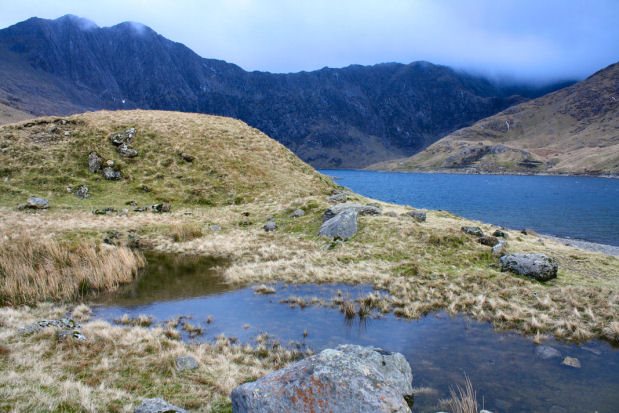
The lake can be reached via the Miners Track which leads up to Snowdon. The causeway across Llyn Llydaw was constructed in 1853 to facilitate the copper mining on this part of Snowdoni - prior to this horses and the extracted copper were carried across Llyn Llydaw by raft. The path skirting Llyn Llydaw and Llyn Glaslyn (now known as the Miner's Track) was constructed at the same time.
A walk to Llyn Llydaw and Llyn Glaslyn
Distance - 8.7 km
Duration - around 4 hours
*Commencing at the car park at Pen-y-Pass on the A4086, proceed west along the popular PYG (Pen y Gwryd) path, to reach the pass of Bwlch y Moch, high above Llyn Llydaw. There are superb views of Snowdon from this path and across to Lliwedd on the left, and up to Crib Goch and Crib y Ddysgl on the right.
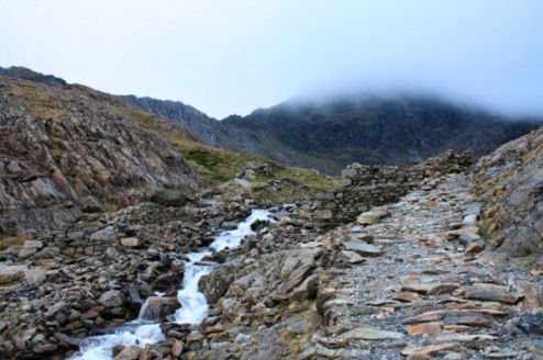
*Proceeed straight on, ignoring the Crib Goch path to the right. Upon reaching a point where the path veers to the right, where Llyn Glaslyn (Welsh for Blue Lake) is visible below, leave the PYG path and continue west down the steep grass slope.
*Join the Miner's Path by the shores of the lake and continue right until reaching some ruined buildings. Retrace your steps, following the shore of Llyn Glaslyn, then descend to follow the north west shore of Llyn Llydaw, before proceeding south east across the Causeway.
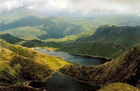
Llyn Lydaw and Llyn Glaslyn viewed from Snowdon
*Continue in an easterly direction on the track past Llyn Teyrn, then bear north to return to Pen y Pass and the car park.